Hiking and Camping in Grand Staircase–Escalante
A Guide to Utah’s Wildest Landscape
Grand Staircase–Escalante National Monument is one of the most remote and rewarding places to hike and camp in Utah. Spanning nearly two million acres of canyon country, slickrock, and desert plateaus, it offers unparalleled opportunities for day hikes, backpacking routes, and primitive camping far from crowds.
Written from the perspective of a professional guide who has spent years exploring and leading trips here, this guide covers what to know before planning a hiking or camping trip in Grand Staircase–Escalante— including when to go, classic hikes, backpacking routes, camping options, and how to travel thoughtfully through this protected landscape.
What is the Grand Staircase?
Despite the name, the Grand Staircase isn’t actually a staircase at all. It’s a series of enormous, stepped plateaus shaped over millions of years, each one defined by the color and age of its rock. As erosion has slowly exposed those layers, the land has revealed a gradual “staircase” of geologic time— moving from younger rock near Bryce Canyon to increasingly older formations as you go south toward the Grand Canyon. The oldest rock visible in this geologic staircase is known as the basement of North America, and it is 1.7 BILLION years old!
The Grand Staircase-Escalante National Monument sits in the heart of this larger geologic wonder. Towns like Escalante, Kanab, Big Water, and Boulder serve as excellent base camps for exploring the region.
When to Go
Late spring and early to mid-fall are absolutely the best times to visit, especially if you want to hit the trails and sleep under the stars. Elevations range from 5,500 to 8,000 feet, meaning winters can be cold and snowy. Summers, on the other hand, bring extreme heat and potential monsoon storms. The shoulder seasons offer the most comfortable temperatures and more ideal conditions, making it a safer and more enjoyable time to plan a vacation
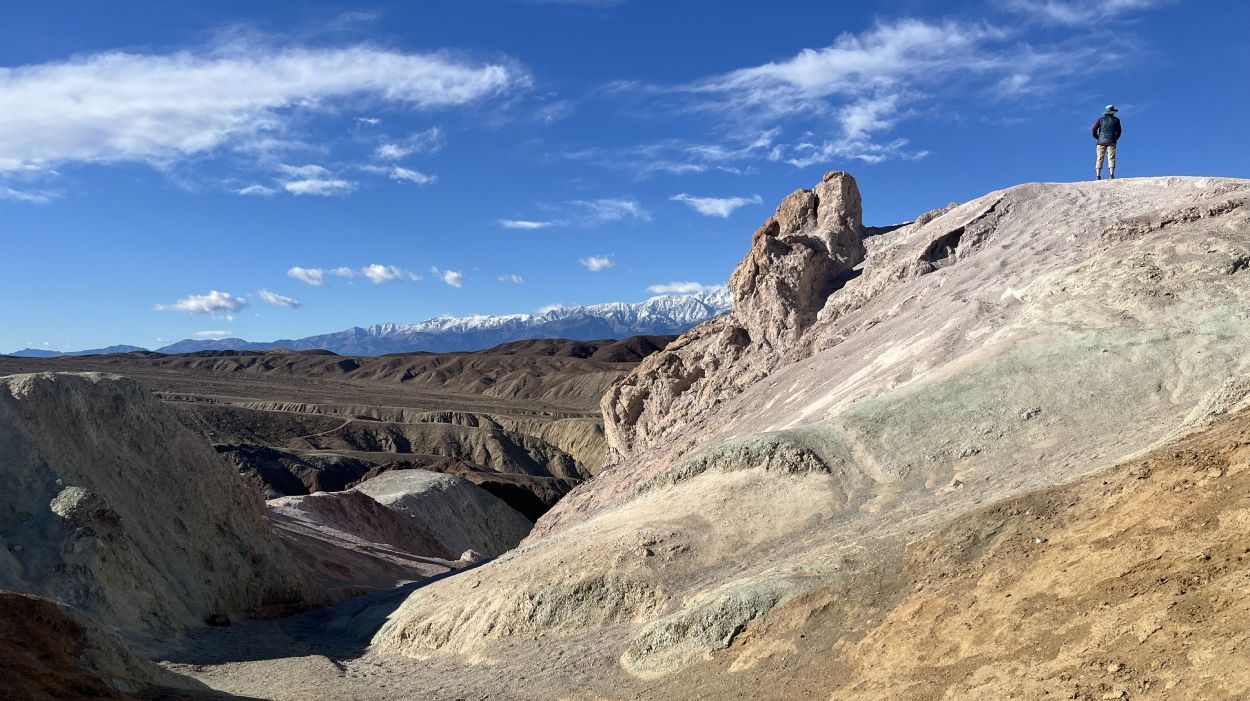
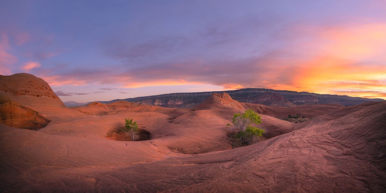
Why Grand Staircase–Escalante Is So Special
When people think of planning a hiking vacation in Utah, they usually imagine the state’s “Big Five” National Parks— iconic arches, dramatic canyons, and postcard-worthy viewpoints that are understandably packed with visitors. While Arches, Canyonlands, Capitol Reef, Zion, and Bryce are absolutely worthy of repeated visits, there is another landscape nearby that is equally as stunning and awe-inspiring, and far less traveled.
Grand Staircase-Escalante National Monument is quieter, more expansive, and undeniably wild. It spans nearly two million acres in southern Utah and is located less than an hour’s drive from Bryce Canyon National Park. The Grand Staircase holds a maze of plateaus, canyons, and ridges with endless slickrock, solitude, and adventure. It is a landscape that has been shaped by deep geologic history and is rich in cultural artifacts from the extensive human history. Not to mention—it also holds what some experts believe to be the highest concentration of dinosaur bones in the world!
Escalante has been my personal escape in Utah for many years, one of my favorite places to guide, and a place I will go back to again and again in this lifetime. It is equally captivating for hikers, backpackers, photographers, or anyone just seeking connection to the desert landscape. This is a place to slow down, to explore thoughtfully, and to challenge yourself if you choose. Most importantly, it is a place to protect so that future generations can experience the same sense of discovery that makes Grand Staircase-Escalante so special.
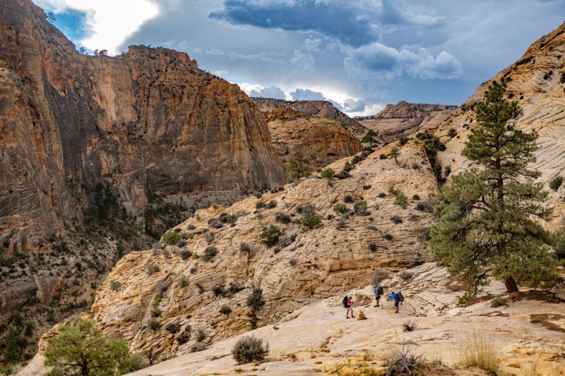
Day Hiking Opportunities
Lower Calf Creek Falls
Distance: ~6 miles roundtrip
Elevation Gain: ~550 feet
Trailhead: Lower Calf Creek Falls, Highway 12 (parking fee required)
One of the most iconic hikes in Grand Staircase-Escalante, this trail leads through a surprisingly lush canyon to a 126-foot waterfall pouring into a clear pool below. Along the way, you’ll pass towering canyon walls, flowing water, and ancient pictographs. The hike is steady and approachable, making it a great option for a wide range of abilities. The cool, shaded oasis at the end offers a welcome break— especially in warmer months. Show up early for this one—parking fills quickly.
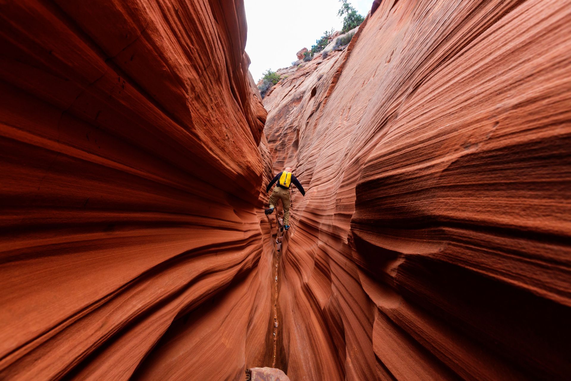
Spooky Gulch & Peek-a-Boo Slot Canyons
Distance: ~6.3 miles roundtrip (loop options vary)
Elevation Gain: ~700 feet
Trailhead: Dry Fork Trailhead, Hole-in-the-Rock Road
These two slot canyons are often paired together and offer one of the most fun, accessible slot canyon experiences in the region. Peek-a-Boo features tall, sculpted, winding walls and playful scrambling, while Spooky lives up to its name with narrow, winding corridors that twist through the sandstone. Neither canyon requires ropes or technical gear, but they do require comfort with tight spaces, uneven footing, the ability to climb up and down short but steep and exposed drops. This hike is not for people who are claustrophobic. It is also imperative to use the installed bars at the trailhead to measure yourself. These are meant to demonstrate how narrow the walls are in Spooky, and you WILL get stuck if you don’t fit between them.
Note: Always check weather conditions before entering slot canyons— flash flooding can occur even when storms are miles away.
Escalante River Trail
Distance: ~6 miles roundtrip (customizable)
Elevation Gain: ~260 feet
Trailhead: Escalante River Trailhead, Highway 12
This mellow river hike is ideal for those who want to spend the day near water. The trail crosses the Escalante River multiple times and winds through a wide, green canyon with plenty of shade. Since the water crossings are necessary, water shoes or sturdy sandals (with a heel strap!) are highly recommended. The distance is flexible since it is an out-and-back— you can turn around whenever it feels right. For a longer day, strong navigators can extend the day to Bowington Arch. Make sure to look up directions before heading out, have a map downloaded, and most importantly— know how to use it.
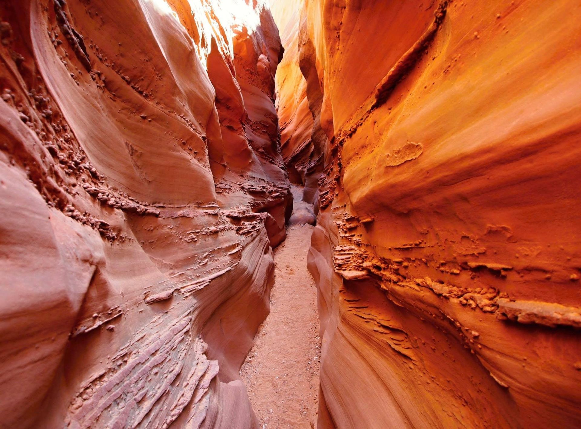
Zebra Slot Canyon
Distance: 5.2 miles roundtrip
Elevation Gain: ~380 feet
Trailhead: Zebra Canyon, Hole-in-the-Rock Road
Another gorgeous slot canyon, known for its striped sandstone walls and typically offers more solitude than peek-a-boo and spooky. Expect water, which is sometimes deep and typically unavoidable. The walls are quite narrow, so it is not for the claustrophobic. If you reach a point where the canyon feels too tight for your body size— turn around rather than testing it. Some fun scrambling is definitely required for this one as well.
Backpacking Trips
Coyote Gulch
Distance: 10–26 miles
Elevation gain: ~700 feet
Trailhead: Red Well, Hurricane Wash, or Fortymile Ridge (all are on Hole-in-the-Rock Road)
Days: best done in 4 days
Perhaps the most famous backpacking trip in the Escalante region, this trip has it all! Towering Navajo Sandstone walls, enormous alcoves, stunning natural bridges and arches, impressive waterfalls, hanging gardens and perennial water, and extremely special ancestral Indigenous sites. It is the most picturesque desert oasis you can imagine, teeming with life and beauty. Because of it’s popularity, it is pivotal that we all protect it. Its popularity also means stewardship is critical. Permits must be filled out at the trailhead or at a Visitor Center, all waste (including human waste) must be packed out, group size is limited to 12, and dogs are not allowed. This is an absolutely breathtaking and inspiring trip that I look forward to doing again and again over my lifetime.
There are several route options, including out-and-back and point-to-point itineraries. Red Well and Hurricane Wash are the most easily accessed. Fortymile Ridge is tougher and requires 4x4 driving on a road with deep sand. It also has a dramatic entry or exit with a “crack-in-the-wall” so tight that some people will not fit through. Most hikers who can fit their bodies still need to haul packs with a rope instead of squeezing them through.
Golden Cathedral
Distance: 10–25 miles, depending on how much you want to explore
Elevation gain: ~1800 feet
Trailhead: Fence Canyon Trailhead, Hole-in-the-Rock Road, 4WD and high clearance recommended
Days: best done as a 3–4 day trip to allow for ample time to explore
Remote and indescribably beautiful canyon country awaits you on this hike. The trail is unmarked and requires solid navigation skills, but the rewards are extraordinary. Descending off of Egypt Bench, you cross open, exposed, and expansive desert as you descend deep into the bottom of Neon Canyon. The Golden Cathedral itself is an aptly named sandstone alcove punctured by sunlight that casts dramatic beams of light into the canyon. The surrounding area offers endless side canyon quests, rock are, and peaceful camps— ideal for a basecamp-style backpacking trip.
Golden Cathedral
Distance: 15–35 miles (best done as a point-to-point; car shuttle is highly recommended)
Elevation Gain: ~2800 feet
Trailhead: Boulder Mail Trail, Hell’s Backbone Road in Boulder, UT
Days: 4–6
Historic, remote, rugged, and full of solitude and breathtaking scenes, the Boulder Mail Trail packs a punch. It is a one-of-a-kind slick rock playground with incredible diversity. With trees that offer shade, open slickrock travel, river hiking, arches, rock art, and archaeology, it is well-worth the trip. Strong navigation skills are essential, but the reward is true solitude.
For a shorter itinerary, start at the Boulder Mail Trail and exit at the town of Escalante, UT where Pine Creek joins the Escalante River. If you have the time and energy though, it is well-worth it to continue along the Escalante River. You’ll get clear desert springs, ancestral dwellings, tall cottonwoods, and an incredible lush oasis to hike through.
Camping in Grand Staircase–Escalante
Hole-in-the-Rock Road
This aforementioned dirt road accesses many of the monument’s most iconic trailheads and offers abundant free dispersed camping. Unless you have a reliable, hardy, 4x4 vehicle, do not attempt to make it to the end. Luckily, there are many free, primitive dispersed campsites available starting at the very beginnning of the road. Please do not impact a new site! There are plenty of already-established sites to pick from. The road is sometimes rough and flat tires are common, so make sure you are prepared with what you need. Also be sure to check current conditions and fire restrictions, bring plenty of water, and bring an emergency communication device.
Calf Creek Campground
Situated right next to the Lower Calf Creek Falls trailhead, this campground is highly desirable, a paid area, and first-come first-served. With about 13 small sites along the creek, you can be lulled to sleep by the sound of soothing running water in the desert.
More Established, Nearby Campgrounds
Kodachrome Basin State Park Campground
- hookups, reservable sites, showers, and hiking trails
- Escalante Petrified Forest State Park
reservable sites, flush toilets, and showers
Bryce View Campground
- reservable sites, vault toilets, and water tap
Backcountry / Primitive Camping
Free permits must be obtained at visitor centers or trailheads before camping in the backcountry. Camping at the trailhead or within 300 feet of springs, seeps, or corrals is not allowed. When choosing a campsite, look for durable surfaces that are already impacted.
Why This Place Still Feels Wild (and Why It Matters)
Grand Staircase-Escalante was protected as a national monument to preserve its unique geology, rich cultural history, and remarkable concentration of natural and paleontological resources. First designated in 1996, reduced by over half in 2017, and restored in 2021, the monument has remained vulnerable to recurring threats from development and resource extraction. Once damaged, these landscapes—and the water, archaeology, and ecosystems within them— cannot be restored.
Spending time here makes that reality impossible to ignore, and one of the reasons I am so passionate about guiding people there. The vastness, silence, and sense of discovery found in Grand Staircase-Escalante still exists only because of its protection. Traveling thoughtfully, minimizing our impact, and following Leave No Trace Principles are so incredible important to help ensure this place remains what it has always been- a desert paradise and playground that I deeply hope many more generations will be able to experience and enjoy.
FREQUENTLY aSKED qUESTIONS
Is Grand Staircase–Escalante good for first-time hikers?
Yes—there are approachable day hikes like Lower Calf Creek Falls and Escalante Natural Bridge. Bu the area offers a wide range of experiences, from moderate day hikes to challenging multi-day backpacking routes. While some hikes are accessible to less-experienced hikers, the area’s remoteness and lack of marked trails make preparation and local knowledge especially important.
Does driving in Grand Staircase–Escalante require 4-wheel drive?
In order to best explore Grand Staircase-Escalante, high-clearance vehicles are highly recommended and 4-wheel drive (or at least all-wheel drive) is very handy. Unlike Utah’s more famous National Parks, this National Monument is largely undeveloped, and many of the trailheads require driving on unmaintained dirt roads that can become impassable when wet. Carrying extra food and water in your vehicle is a great idea, just in case you find yourself stuck somewhere.
Do I need a permit to camp in Grand Staircase–Escalante?
For backcountry/primitive camping, free permits must be obtained at visitor centers or trailheads before camping in the backcountry. (See “Backcountry / Primitive Camping” above.)
What is the best time of year for hiking and camping in Escalante?
Spring and fall offer the most reliable conditions, with cooler temperatures and generally stable weather. Summer heat and monsoon storms require careful planning, while winter brings cold temperatures and occasional snow at higher elevations.
Are slot canyons safe to hike on my own?
Slot canyons can be amazing—and hazardous. Weather and flash-flood risk are real, even when storms are far away. If you’re uncertain, choose a guided trip or stick to conservative routes and conditions.
About the Author
Lead Guide
Four Season Guides
Danielle (Dani) grew up in Connecticut where she spent her childhood days exploring the woods of New England, camping, fishing, and biking. After graduating from the University of Connecticut with a degree in Psychology, Dani made the decision to live out her dream of moving to Colorado. She completely fell in love with the incredible mountains and deserts of the Southwest and quickly committed herself to turning that love into her career. She has been a naturalist in Southwest Colorado, a Wilderness Therapy Guide in Idaho, a Life Skills Mentor/ Adventure Guide in Sedona, AZ, and a Llama Trekking Guide in Northwest Montana. For the past handful of years, she has been a backpacking guide in AZ, UT, WY, ID, and MT. Dani loves to share her passion for exploring wild places with her guests and finds great fulfillment in helping others to experience the backcountry. When not guiding, you can find Dani meeting her friends around the country for an adventure, mountain biking, trying a new recipe, or creating a variety of art.
Four Season Guides, 506 N Grant St suite o, Flagstaff, AZ 86004, United States
+19285251552
35.19653980, -111.62000560
Read More